
At Droneswarm we are always embracing the latest technology.
Precision Planning with 3D Venue Models
Imagine having an intricately detailed, to-scale representation of the venue at your fingertips. 3D venue models offer precisely that. From stadiums to parks to cityscapes, these digital twins provide a comprehensive view of the environment, including architectural features, topography, and spatial dimensions.
Designing Drone Shows with precise 3D venue models
With a 3D model of the venue in hand, our designers can meticulously plan drone shows with unparalleled precision. We can choreograph intricate flight paths, synchronise movements with music or narration, and visualise the entire performance in a virtual space before a single drone takes flight.
The ability to simulate various scenarios and perspectives allows for the creation of awe-inspiring aerial displays that seamlessly integrate with the venue’s architecture and surroundings. Moreover, designers can optimise safety by identifying potential hazards and ensuring that drones maintain safe distances from structures and spectators.
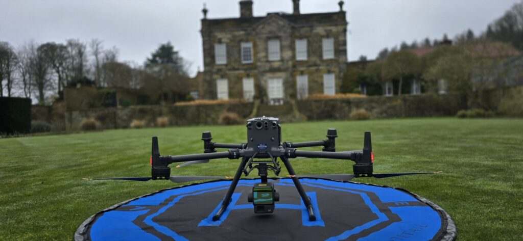
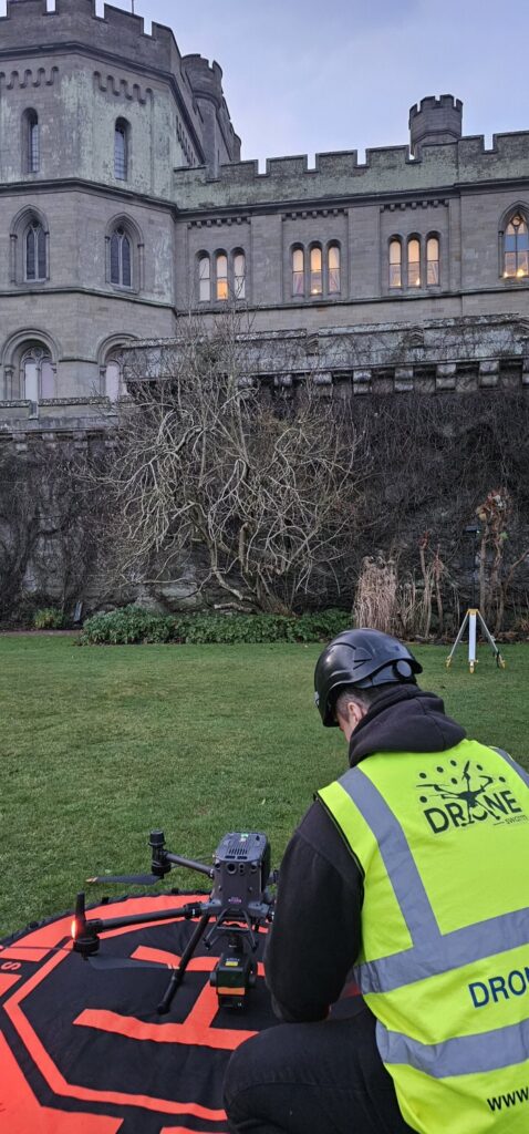
Find out more about how we create a 3D model of your display location using state of the art laser scanning technology:
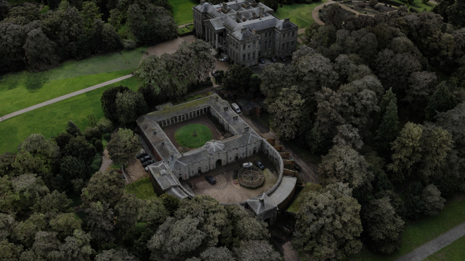
A LIDAR (Light Detection and Ranging) drone is an unmanned aerial vehicle (UAV) equipped with LIDAR technology for remote sensing and mapping applications. LIDAR drones use laser pulses to measure distances to the Earth’s surface, creating highly accurate 3D models of terrain, buildings, vegetation, and other features. These drones are commonly used in various fields such as agriculture, forestry, urban planning, environmental monitoring, archaeology, and infrastructure inspection.
These images below are 3D models created by our LIDAR drone:

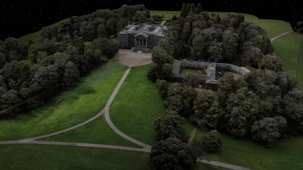
Every precise detail can be measured from heights of trees to the lay of the land.
Get in touch to plan your show – www.droneswarm.co.uk

Comments are closed